Sidewalk widths - Sharedstreet
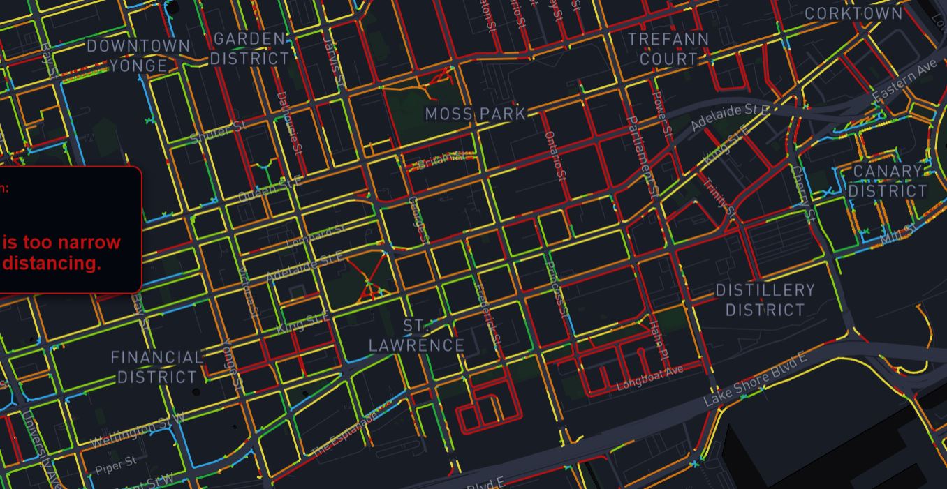
This map is intended to give an impression of how sidewalk widths impact the ability of pedestrians to practice social distancing.
Widths were determined from the City of Toronto's open sidewalk data. This source data was not verfied for accuracy or completeness. The sidewalk data also does not include off-street trails and multi-use paths, which may offer additional routes for pedestrians.
This site borrows methods and code from Meli Harvey's Sidewalk Widths NYC project, adapted to Toronto's context. To learn more about how this dataset was produced, visit the Sidewalk Widths
Villes catographiées avec l'outil:
Organisations utilisatrices ou intéressées pour utiliser la ressource : Le centre d’excellence des communs technologiques pour la mobilité, Collectivité Territoire
Contributeur(s) :
Tags : dataviz, curb space, trottoir
Catégories : Logiciel, Données
Thème : Données ouvertes, Urbanisme et ville, Logiciel Libre
Référent :
Défi auquel répond la ressource : Accompagner une collectivité à ouvrir un maximum de ressources et construire un kit d'aide à l'innovation
Personnes clés à solliciter :
Autre commun proche : CurbLR, Shared streets, Open Sidewalks, Sidewalk widths - Sharedstreet, Largeur des trottoirs
Richesse recherchée :
Compétences recherchées :
Communauté d'intérêt : Communauté des acteurs de la logistique urbaine, Communauté des Territoires et Collectivités, Communauté des acteurs des Hubs de démobilité et de la démobilité
Type de licence :
Conditions Générales d’Utilisation (CGU) :
Niveau de développement :
Lien vers l’outil de gestion des actions :
Lien vers l’outil de partage de fichiers : https://github.com/sharedstreets/sidewalkwidths-toronto
Besoins :
Prochaines étapes :
Documentation des expérimentations :
Autres informations
Liste des acteurs qui utilisent ou souhaitent utiliser ce commun : aucun pour le moment
Liste des CR d’atelier en lien avec ce commun :

 Français
 English
 Italiano