Open Sidewalks
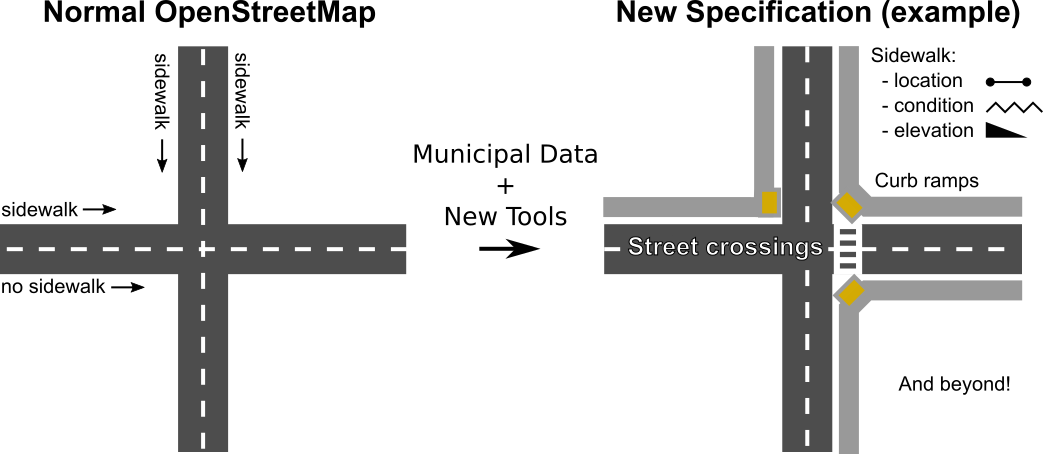
Sidewalks provide a primary mode of travel that supports nearly all other travel options, leisure, recreation and community activities. This project seeks to make pedestrian ways, particularly sidewalks, first class members of an open data transportation network. The OpenStreetMap (OSM) project has made available extensive, user-contributed open data on transportation networks, providing the basis for many use cases and downstream activities, including rich analytics, travel route optimization, city planning, and disaster relief. Some footways have been annotated in OSM as independent routes. However, sidewalks in the built environment have generally been treated an addendum to streets.
Organisations utilisatrices ou intéressées pour utiliser la ressource : Collectivité Territoire
Contributeur(s) :
Tags : trottoir, sidewalk
Catégories : Logiciel, Données, Communauté
Thème : Open Street Map OSM, Accessibilité dans les transports, Données ouvertes, Logiciel Libre
Référent :
Défi auquel répond la ressource : Augmenter les connaissances partagées en cartographie et usages des véhicules et réseaux de transports
Personnes clés à solliciter :
Autre commun proche : Shared streets
Richesse recherchée :
Compétences recherchées :
Communauté d'intérêt : Communauté du Logiciel Libre
Type de licence :
Conditions Générales d’Utilisation (CGU) :
Niveau de développement :
Lien vers l’outil de gestion des actions :
Lien vers l’outil de partage de fichiers :
Besoins :
Prochaines étapes :
Documentation des expérimentations :
Autres informations
Liste des acteurs qui utilisent ou souhaitent utiliser ce commun : aucun pour le moment
Liste des CR d’atelier en lien avec ce commun :

 Français
 English
 Italiano