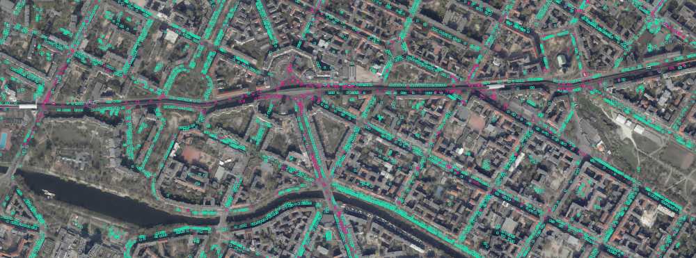
Car tagging data
This repo is about the data collected by volunteers using a map tagging tool which was developed to tag cars on aerial images from the city of Berlin
This repo is about the data collected by volunteers using a map tagging tool which was developed to tag cars on aerial images from the city of Berlin. It is a work in progress but some areas of Berlin are complete and ready to be downloaded: Friedrichshain-Kreuzberg
The data is subject to change.
Contact : I would be happy to hear if you worked with this data set. If you want to help creating more data sets by tagging cars on satellite images yourself or have any other questions you can contact me via: [[1]]
Organisations utilisatrices ou intéressées pour utiliser la ressource : Collectivité Territoire
Contributeur(s) :
Tags : comptage, Voiture, parking, image, satellite
Catégories : Logiciel, Données
Thème :
Référent :
Défi auquel répond la ressource : Accompagner une collectivité à ouvrir un maximum de ressources et construire un kit d'aide à l'innovation, Maximiser les usages de l'espace public (personne et marchandise), Augmenter les connaissances partagées en cartographie et usages des véhicules et réseaux de transports
Personnes clés à solliciter :
Autre commun proche : Cars Overhead With Context, Arrogance of space
Richesse recherchée :
Compétences recherchées :
Communauté d'intérêt : Communauté du Stationnement de du curbspace, Communauté autour des données ouvertes
Type de licence : ODC Open Database License (ODbL)
Conditions Générales d’Utilisation (CGU) :
Niveau de développement :
Lien vers l’outil de gestion des actions :
Lien vers l’outil de partage de fichiers :
Besoins :
Prochaines étapes :
Documentation des expérimentations :
Autres informations
Liste des acteurs qui utilisent ou souhaitent utiliser ce commun : aucun pour le moment
Liste des CR d’atelier en lien avec ce commun :

 Français
 English
 Italiano