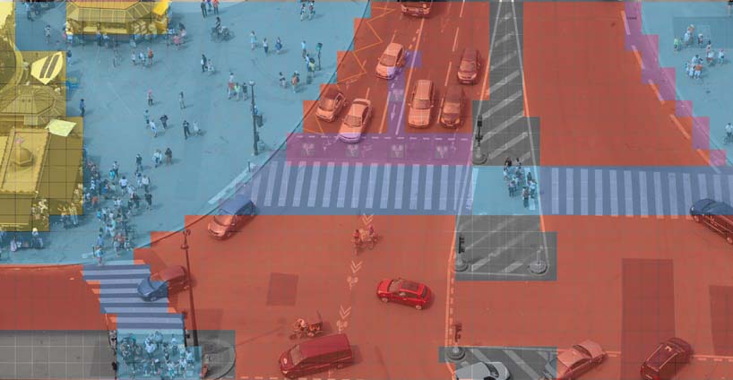
Arrogance of space
Upload an aerial or satellite photo from your city - an intersection or neighbourhood - and start mapping how much space is allocated to cars, pedestrians and bikes. This simple tool allow self quantification of space dedicated to car, bike, pedestrians.
Organisations utilisatrices ou intéressées pour utiliser la ressource :
Contributeur(s) :
Tags : espace public, arrogance
Catégories : Logiciel, Données
Thème : Données ouvertes, Urbanisme et ville, Logiciel Libre, Collectivité
Référent :
Défi auquel répond la ressource : Améliorer la résilience des systèmes de transports et des solutions de mobilités, Maximiser les usages de l'espace public (personne et marchandise), Accompagner une collectivité à ouvrir un maximum de ressources et construire un kit d'aide à l'innovation
Personnes clés à solliciter :
Autre commun proche : Streetmix
Richesse recherchée :
Compétences recherchées :
Communauté d'intérêt : Communauté Vélo et Mobilités Actives, Communauté des acteurs de la logistique urbaine
Type de licence : GNU Affero General Public License
Conditions Générales d’Utilisation (CGU) :
Niveau de développement :
Lien vers l’outil de gestion des actions :
Lien vers l’outil de partage de fichiers :
Besoins :
Prochaines étapes :
Documentation des expérimentations :
Autres informations
Liste des acteurs qui utilisent ou souhaitent utiliser ce commun : aucun pour le moment
Liste des CR d’atelier en lien avec ce commun :

 Français
 English
 Italiano