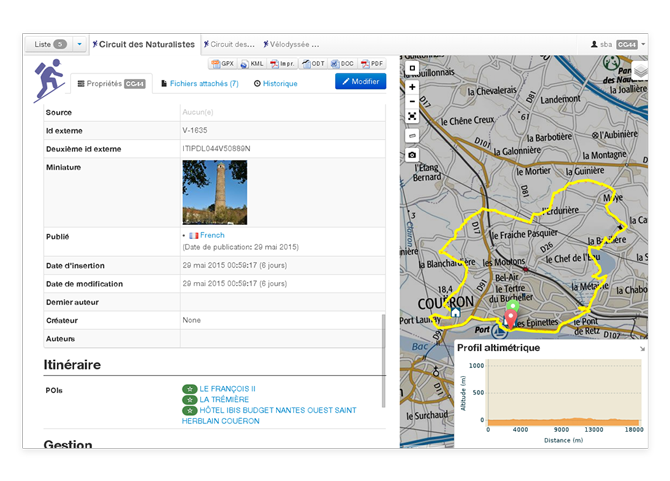
Geotrek
In brief
- Manage paths, treks and POIs
- Track maintenance of equipments and infrastructures
- Control objets by district, protected areas, physical and legal status of paths
- Compute 3D attributes using DEM draping
- Publish a public website with Geotrek-rando (e.g. PNE, PNM-PNAM)
- Publish a public mobile application with Geotrek-mobile (e.g. PNE, PNM-PNAM)
More information on product website http://geotrek.fr
Documentation
- More info at http://geotrek.fr (french)
- Installation and configuration instructions
- Help us translate on Transifex
Organisations utilisatrices ou intéressées pour utiliser la ressource :
Contributeur(s) :
Tags : vélo, bike, carte, hackathon
Catégories : Logiciel, Connaissance
Thème :
Référent :
Défi auquel répond la ressource : Augmenter les connaissances partagées en cartographie et usages des véhicules et réseaux de transports
Personnes clés à solliciter :
Autre commun proche :
Richesse recherchée :
Compétences recherchées :
Communauté d'intérêt : Communauté Vélo et Mobilités Actives, Communauté des Territoires et Collectivités
Type de licence : BSD
Conditions Générales d’Utilisation (CGU) :
Niveau de développement :
Lien vers l’outil de gestion des actions :
Lien vers l’outil de partage de fichiers :
Besoins :
Prochaines étapes :
Documentation des expérimentations :
Autres informations
Liste des acteurs qui utilisent ou souhaitent utiliser ce commun : aucun pour le moment
Liste des CR d’atelier en lien avec ce commun :

 Français
 English
 Italiano