Mobility Map
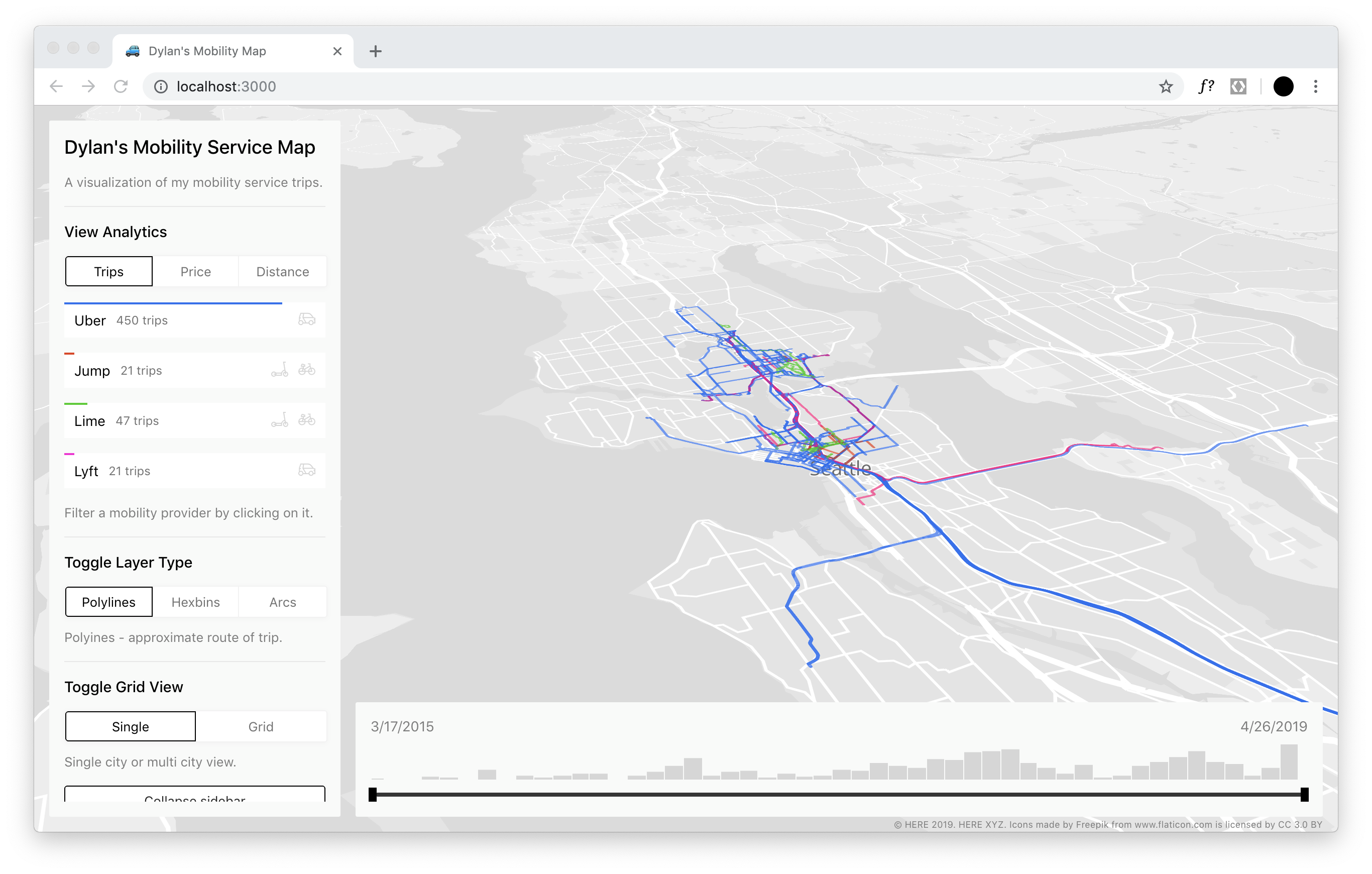
This project is an interactive visualization of my mobility service provider trips
Mobility Map : https://dbabbs.github.io/mobility-map/
Data access
Uber provides a handy data download tool that provides access to all Uber trips, UberEATS orders, and JUMP trips. Submit a request for your data and it should be ready to download in a few hours.
Lyft enables a download of your trips through the Ride History in the mobile app. You can email yourself a CSV of your recent trips.
Lime was a little more difficult to get a copy of my data. They do not provide an easy export of your trip data like Uber and Lyft. Since I had used Lime in Berlin, I was eligible to request a copy of data under Article 15 of GDPR - Right of access by the data subject. Nearly 2 months and 10+ emails later with Lime, I finally received a copy of my data. Enriching the data
Except for Lime, my trips data only included start and end addresses. The actual path travel was not included in the data downloads. In order to draw polylines on the map, I used the HERE Routing API to calculate the estimated route from the starting point to the ending point. This process happened in the prep/index.js file.
Visualizing the Data
Organisations utilisatrices ou intéressées pour utiliser la ressource : Collectivité Territoire
Contributeur(s) :
Tags : uber, trace, data, dataviz
Catégories : Logiciel, Données
Thème : Vélo et Mobilités Actives, Données ouvertes, Traces de mobilité et des données associées, Logiciel Libre
Référent :
Défi auquel répond la ressource : Augmenter les connaissances partagées en cartographie et usages des véhicules et réseaux de transports
Personnes clés à solliciter : Dylan Babbs
Autre commun proche : Vis gl a suite of visualization frameworks, Kepler.gl geospatial analysis tool
Richesse recherchée :
Compétences recherchées :
Communauté d'intérêt : Communauté autour des données ouvertes, Communauté autour des traces de mobilité et des données associées, Communauté du Logiciel Libre
Type de licence :
Conditions Générales d’Utilisation (CGU) :
Niveau de développement :
Lien vers l’outil de gestion des actions :
Lien vers l’outil de partage de fichiers :
Besoins :
Prochaines étapes :
Documentation des expérimentations :
Autres informations
Liste des acteurs qui utilisent ou souhaitent utiliser ce commun : aucun pour le moment
Liste des CR d’atelier en lien avec ce commun :

 Français
 English
 Italiano