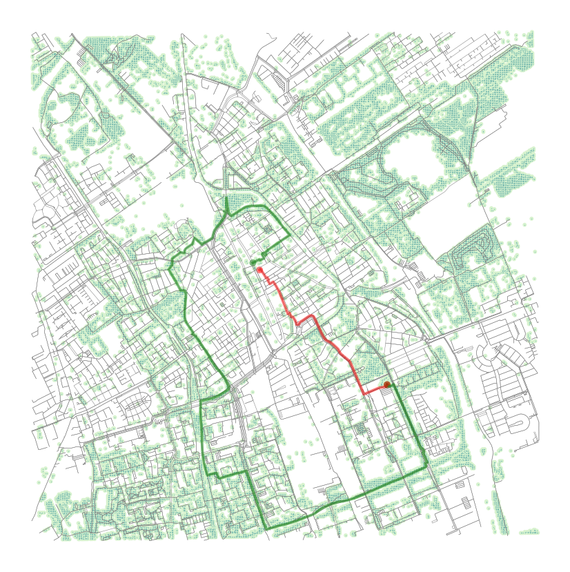
Shady streets: Finding the shortest cycling path in the shade
Description en une ligne : Tool to create a bike planner that propose path that have more shade.
Description : Last week, the Netherlands was hit with an unprecedented heat wave where temperatures reached as high as 40 degrees Celsius. When I was about to get on my bike to cycle home in the blistering heat, I thought to myself, “I wish Google Maps could give me directions to cycle home in the shade. In fact, I’d probably be willing to cycle an extra 10 minutes just to stay in the shade.”
Lieu d’utilisation/expérimentation :
Geocode the address to put it on the map
Site web : https://medium.com/@tanyamarleytsui/shady-streets-6dad0979c13a
Tags :
Thème : Open Street Map OSM, Vélo et Mobilités Actives, Données ouvertes, Logiciel Libre
Organisations intéressées pour contribuer ou qui contribuent déjà :
Organisations utilisatrice ou intéressée par utiliser la ressource :
Véhicule(s) impliqué(s) dans le projet :
Contributeurs :
Référent :
Défi auquel répond le projet :
Commun(s) utilisé(s) : OSM Data
Commun(s) produit(s) :
Communauté(s) d’intérêt associé(s) :
Personnes clés à solliciter :
Niveau de développement : :
Lien vers l’espace de discussion :
Lien vers le salon chat :
Lien vers l’outil de gestion des actions :
Lien vers l'espace de partage de fichiers, documentation :
Besoins :
Complément :
Prochaine étape :
Vous avez des questions ou commentaires sur cette page : Discussion:Shady streets: Finding the shortest cycling path in the shade
Autres informations :

 Français
 English
 Italiano